Despite being compact in size (at least, most of them) drones are built on big ideas and backed by some pretty complicated technology. That technology keeps on improving year on year too, and many drones differ in terms of onboard hardware and software, making it even harder to keep up with this fast-paced industry.
Despite all that, we’re going to take a stab at breaking all of this down here for you in easy-to-understand sections. We’re going to be looking at how drones work, what makes them tick, how the technology is improving, and what the future of drone flying looks like. So grab a drink and let’s dive right in.
Disclaimer: We’ll try our best to provide up-to-date information and cover a wide range of drone tech on the market, but we’ll mainly be sticking to what the more popular models like the DJI and Force1 UAVs can do.
What is a Drone?
Drones, also called UAVs (unmanned aerial vehicles) or RPAS (Remotely Piloted Aerial Systems) are small aircraft that can be piloted remotely. They come in many different forms and are used for a variety of applications both recreationally and commercially. Drones had their start in military applications, but have become a popular consumer product.
How Do Drones Work?
Without going into all of the particulars of aerodynamics and how planes get into the sky through lift generated by thrust, etc., at the heart of it, drones are like small planes – or helicopters since most of them use rotors – except that they are unmanned. Instead, drone operators pilot them safely from the ground by using a combination of a controller, view from the ground, and first-person view through the drone’s camera and a mobile device screen (usually).
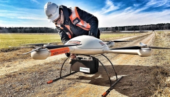
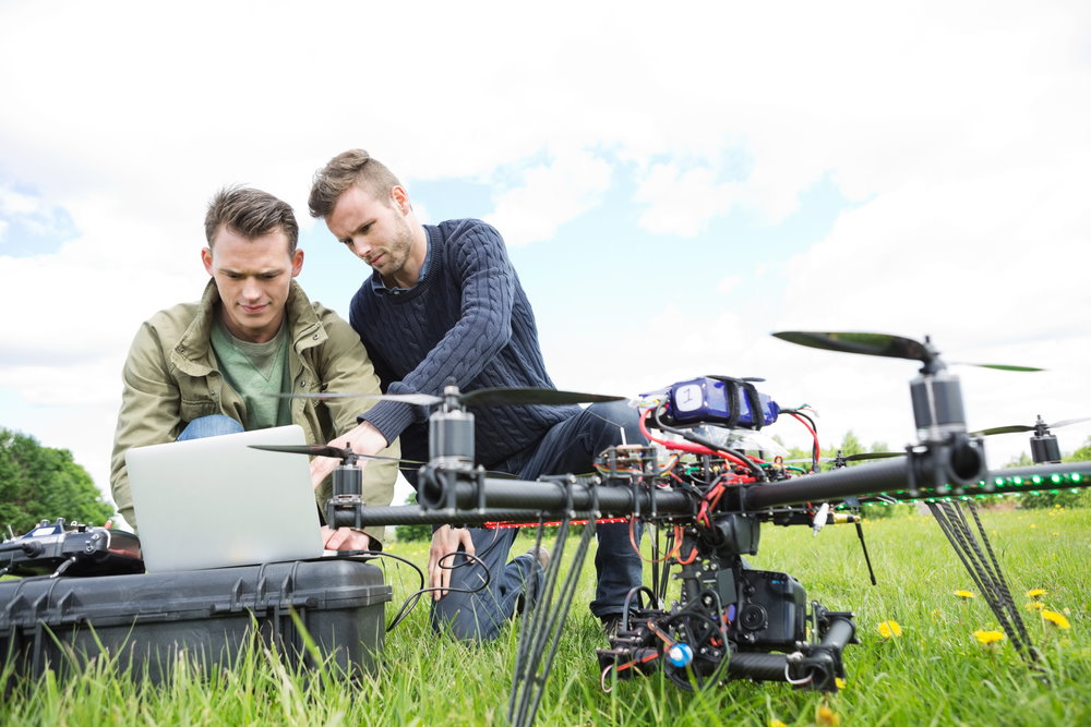
Drones are typically made of lightweight but strong materials, that are designed to absorb a lot of vibration and reduce the shaking caused by the propellers and wind. Drones carry complex machinery onboard, from GPS and multispectral sensors to infrared cameras. All of this is packed within the main body of the drone, although some elements like the camera, battery, and propellers are usually attached separately and can be removed.
Drones Come in All Shapes and Sizes
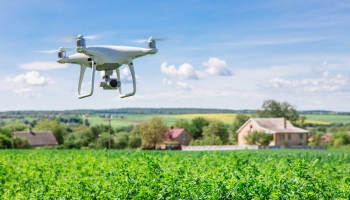
Despite the current popularity of small, > 5-pound quadcopter drones, UAVs are actually quite diverse, with new types being created all the time. Besides quadcopters, there are other types of multirotor drones like tricopter and hexacopter, even some octocopter drones. But there are also single-rotor drones (more commonly known as helicopters), fixed-wing drones that look a little like regular airplanes, and hybrid drones that combine rotors and fixed-wing features.
With all of that variety, there’s quite a lot to explore.
A Guide to Drone Technology
To keep things simple, we’ve split this guide into various subcategories that you can explore as you like.
Controls and Input
Remote Control System/Transmitter
All drones will either work with a drone controller (also called a transmitter or ground station controller) or a smartphone app. Using this, a pilot or operator steers the drone from the ground. In addition to other data, drones also transmit live video feed from the drone’s camera, providing a first-person – or birds-eye view – of the area the drone is flying above.
Drone controllers have four main flight controls – a left stick that controls the drone’s yaw and throttle, and a right stick that controls pitch and roll. Many controllers also come with some additional buttons that provide more advanced controls. Controllers that work with smartphones/tablets also have an app that not only provides the video feed from the drone’s camera but also additional controls and settings for the drone.
Realtime Telemetry
Drone controllers/apps provide a whole host of data, also called telemetry data, in real-time. This includes everything from how fast the drone is flying, how high it’s flying, its battery percentage, temperature, and more. It will also usually throw up error messages if there’s anything wrong with the GPS connection or drone. Using this feedback, an operator can be sure they’re piloting the drone to the best of their ability.
On-Board Hardware
Drone Propulsion Technology
Also known as the propellers, in single- and multi-rotor drones these blades turn quickly to work against gravity and lift the drone. In an average consumer drone, the blades turn at a rate of around 8000 RPM (rotations per minute). The rotors are either connected to the arms of the drone or on top, as is the case with single-rotor drones.
These are powered, of course, by different motors. They’re also connected to an electronic speed control or ESC (an electronic circuit), which relays the instructions from the controllers (accelerate/decelerate) to the propellers. Most drone propellers can be removed from the drone without harming the device for maintenance, replacement, and safe transport.
Naturally, there’s a lot of elements that go into making these tiny – and sometimes not so tiny – propellers work. Including motor stators and bells, bearings, windings, and even a cooling system.
Always keep your fingers, and any other digits, far away from the propellers when they’re turned on. Even small drone propellers can do quite a bit of damage to human skin!
Gyroscope Stabilization
Ever wondered how drones manage to stay upright despite flying in different directions with wind interference? It’s all thanks to the gyroscope which works to stabilize the UAV. The gyroscope measures the rotation and tilt of the drone every few seconds and sends signals to the propellers to stabilize the drone if it’s heading too much in any direction, outside of the pilot’s input of course. For example, if the drone is tilting too much to the right, the gyroscope will tell the propellers on that side to rotate faster to make up for the drift to keep the drone balanced.
LED Flight Indicators
Almost all commercial drones come with LED lights to some degree. These lights are often used to help see the drone, but can also provide important indications such as when the drone’s compass is being set up. The lights usually come in variations of white, green, yellow, or red, and can be either solid or blinking. Anyone who wants to fly their drone at night is required to have adequate lights on their drones, which may require purchasing and installing additional lights or looking for a drone with that feature already pre-installed.
Remote Control Receiver
Every drone comes equipped with both a controller/app (transmitter) and a receiver. The receiver is attached to the drone and receives then relays all of the signals sent from the controller. For this to work, the transmitter and receiver have to be on the same frequency, and some frequencies can travel for longer distances than others. That’s something to keep in mind when picking out a drone, depending on how far you want to be able to fly. Although most commercial drones should be able to fly far enough for most consumer needs.
Sensors
Some drones are equipped with multiple sensors for various data-gathering purposes. For example, drones can be equipped with lidar and Time-of-Flight (ToF) sensors that help with obstacle avoidance, object scanning, 3D photography, and more. Photogrammetry sensors are used to capture 3D models of landscapes and buildings. Multispectral sensors create Digital Elevation Maps (DEMS) that can be used to assess the health of crops and other flora and fauna.
Some UAVs come with low light or night vision sensors to track animals and other data points at night, and some have thermal vision sensors to help with firefighting, agriculture, and other important functions. Pretty much anyone can buy a thermal camera drone, but they are expensive and FAA laws with regards to privacy still apply.
Drone Cameras
Since drones have become relatively synonymous with cameras, pretty much every commercial drone on the market either comes with a camera attached or supports a camera attachment. The cameras on drones can differ greatly in terms of quality. Not everyone needs a 4K drone though, especially beginners or hobby enthusiasts. Cheaper drones can come in at 720p but even 1080p camera drones are starting to become more affordable.
Of course, photographers and videographers will look at more than just the pixels/resolution the camera has to offer. Other metrics that might make a difference include ground sampling distance (GSD), spatial resolution, and even the drone’s lighting system for low light/night shots.
Gimbal Technology
Most drone models come equipped with a camera and the camera is usually attached to the drone via a gimbal. Some drones come without a gimbal and camera, which have to be purchased separately, but many consumer drones available today already have these attached.
The gimbal helps reduce vibration to prevent fuzzy shots and helps to stabilize the camera.
Gimbals with Integrated Zoom
In the past few years, drone technology has advanced quite a bit, and drones with integrated gimbals that have either optical or digital zoom capabilities are now widely available. Some even offer a combination of both optical and digital zoom.
They can be more suited to different applications as well, depending on their capabilities. Some, for example, are more suited to still photography while others are best used for more practical applications like professional inspections. High-end drones with these capabilities, like the Walkera Voyager 4 have incredible magnification capabilities, with an 18-times optical zoom camera that is capable of 360-degree 4K filming. All of which is made possible, of course, with the gimbal integration that provides excellent stabilization mechanics.
IMU Technology in Drones
The inertial measurement unit (IMU) uses accelerometers situated in the drone’s body to detect the current rate of acceleration of the drone. The IMU also works with the drone’s gyroscopes to detect rotational changes in movements like pitch, roll, and yaw and works in tandem with other systems to stabilize the drone. Some IMUs also have a magnetometer to assist with calibration against orientation drift.
Drone Software
Sensor Fusion Software
This software combines the inputs from several different sensors on the drone to improve system performance. By combining all the different data, the program is able to correct any mistakes or lack of data from any single sensor. This can be used for different things, including the drone’s positional tracking and automatic orientation adjustments.
There is plenty of other drone sensor software that can be incorporated too, depending on the sensors the drone has and the operator’s needs. For instance, there are different types of 3D mapping software that work with a drone’s lidar or photogrammetry sensors to capture accurate images of 3D models and landscapes and stick them together in a program to create a singular map or video. In that case, the drone will fly over a landscape (usually autonomously, as programmed by the software) and take images at half-second intervals which it will send back to the software where the images are stitched together. The result is a massive, incredibly detailed image.
Drone Operating Systems
You might think that drones all use the same operating system, but it does differ. There is a variety of options on the market, although many of these operating systems like FlytOS and Auterion are built using Linux and some even support Microsoft Windows, Mac, iOS, and Android.
However, Linux is by far the most prevalent, with The Linux Foundation also releasing the Dronecode Project which aims to provide an open-source platform for UAVs. The project hopes to unite both existing and future drone operations under one nonprofit structure that isn’t controlled by any single corporation.
GPS Positioning
Every drone is equipped with a compass that has to be calibrated in order for the “Ready to Fly Mode” to be activated. Usually, you just have to calibrate the compass before your first flight, but sometimes it needs to be recalibrated due to an error, interference, or damage from a fall.
The compass or GPS module works with various orbiting GPS satellites, and a strong connection to at least 6 satellites is needed to pinpoint the drone’s location as well as its relation to true north. Drones cannot fly properly without a proper GPS connection, and if the connection is poor, many functions like waypoint navigation, autonomous flight, and return to home, won’t work.
Autopilot
The autopilot software in a drone works in tandem with GPS positioning and all of the other sensors and inputs the drone has to fly the drone. When connected to satellites, most drones also have waypoint GPS navigation which allows them to fly on their own via predetermined locations already set by the drone controller. There are also different configurations available here that instruct the drone on how fast to fly and at what height, for example. Some drones can also be instructed to hover at certain waypoints. Some other drone functions, like “Follow Me” and “Return Home” also rely on autopilot software to work.
Obstacle Detection And Collision Avoidance
The latest drones on the market right now come with tech that helps with collision avoidance. The software works in tandem with obstacle detection sensors situated on the drone that are constantly scanning the drone’s surroundings.
These drones don’t just use one type of sensor to gather all of that data, though, but instead use a combination of multiple sensors, including lidar, vision sensors, infrared, and ultrasonic sensors to relay information to the drone. This information is then processed using software algorithms and SLAM technology to create an accurate 3D map of the drone’s surroundings, which the software then uses to know where the obstacles are in the drone’s flight path. All of these complex processes happen in real time.
Not all drones have the same setup or capabilities, however. Some drones have obstacle sensing on all sides, allowing them to detect obstacles no matter the direction they’re flying in – even backward. Others have less. For example, some only have sensors on the front, left, and right-hand sides, allowing them to avoid obstacles directly in front and to the side, while some have sensors on 5 sides, but can only avoid obstacles on 4 sides, which is still pretty amazing.
Drones also differ in the way that they process the data they gather from the various sensors they use. For example, on DJI drones that have these capabilities, it’s known as APAS (Advanced Pilot Assistance System) and it uses vision and infrared sensors to feed visual data into a processor which will then tell the drone how to fly around obstacles.
While there are plenty of reasons why obstacle detection and avoidance are useful outdoors, such as with the return to home function, it can be even more valuable for indoor flying. Inventory counting, critical inspections, and other logistical applications benefit greatly from this technology. It is also essential for any drone delivery applications.
Return to Home/Failsafe Function
These days, almost all drones have the ability to set a home point so that it can be told to return to that spot automatically. There’s usually a failsafe feature built into this function as well that will take over control of the drone in case of an emergency (such as when the drone loses connection with the controller) and fly it safely back to the home point. Naturally, this works in tandem with other features like autopilot and collision avoidance to keep the drone safe on its route back. Just keep in mind that you have to set a home point first before your drone will be able to fly there. If you forget to set a home point then the drone won’t automatically return, but most drones will remind you to do this anyway.
FPV Live Video Transmission
FPV stands for “first-person view” and almost all drones come equipped with the ability to record footage – or at least are able to have a camera attached to record footage. When the drone is on, the camera will broadcast live footage to the UAV pilot on the ground, usually via a mobile app. Although some controllers do come with screens of their own, which means no additional devices or apps are necessary.
Like the drone controller and receiver combo, the drone camera uses radio signals to transmit the live feed to the controller or Wi-Fi for the smartphone app. Additionally, like the controller, this connection also has a limited range. Small toy drones typically have a short range of a few hundred yards, while mid-level drones can reach up to 1.5 miles and high-end consumer drones can go as far as 5 miles. Keep this in mind when picking out a drone.
FPV video transmission allows drone operators to pilot their drones as if they’re on-board the drone instead of flying it from the ground. It gives them a birds-eye view of what the drone is seeing from the air. Most operators use a combination of line of sight view and FPV through the camera feed. Keep in mind that in the US, the FAA is in charge of UAV regulation and the law requires that drone operators keep their drones within line of sight at all times without the use of additional apparatus. This can, however, include additional visual observers that are in contact with the pilot at all times. The point being that, FPV shouldn’t replace keeping the drone within line of sight – at least so long as the law stays the same.
Besides the obvious uses such as in surveying and photography, thanks to FPV, drone pilots are able to fly their drones with more precision and better avoid obstacles. This has also led to some other drone ventures, like drone obstacle courses and the extremely popular drone racing leagues. Some manufacturers have even released racing drones with these specific purposes in mind.
Firmware Updates
Much like any other piece of technology, drones will receive the occasional firmware update from their manufacturers. These updates can include various improvements, fixes, security updates, and even add new functions to the drone as they’re adopted and released by the company.
Whatever the update entails, it is essential that you download it as soon as possible. So regularly check your manufacturer’s website and newsletters to see if a new firmware update is available. The same goes for the software if you’re using an app for your drone. This is especially important with regards to safety, as drones continue to get more popular and thus become bigger targets for hackers and other unscrupulous groups. You certainly don’t want a stranger privy to your drone’s camera or, even more alarmingly, able to control it remotely.
Additional Drone Functions
A lot of the latest high-end drones come with a host of additional functions and features that can come in handy in a variety of situations. These functions can usually be accessed via the mobile app or integrated screen on the controller. The amount and type of features you’ll get really depend on the drone and manufacturer, but here are some of the more standard features that you’ll come across.
No-Fly Zone
Many manufacturers of popular brands like DJI have started implementing “No Fly Zone” features into their drones through firmware updates. This feature is based on FAA regulations so is only available to US residents at this time, but it’s a pretty nifty feature that helps drone pilots stay out of unsafe and/or controlled airspace. Although there are other entities across the world that are working on and have implemented similar technology in their own countries.
For DJI, this is called the Geospatial Environment Online (GEO) system, also colloquially known as geofencing. The system displays varying levels of warnings depending on the zone people try to fly in. When someone tries to take off with their drone in an area where the airspace is restricted, the drone will physically be prevented from taking off. Of course, a lot of people dislike this feature for varying reasons and there have been attempts to circumvent or turn this feature off. Just be aware that if you try to mess with the drone’s system
Follow Me
Even though it’s called follow me, this drone function doesn’t just allow operators to have the drone follow themselves. It can be used to track a variety of targets, such as people, boats, cars, and other objects.
The latest drones are able to track their subject with pretty spectacular accuracy, almost never losing sight of the person or object once it starts moving. The drone uses multiple hardware and software capabilities such as detection sensors, a visual processing system, and GNSS systems in tandem to achieve this.
The only caveat here is that with follow me, the drone follows the mobile transmitter’s GPS position, which means that the thing/person it’s following has to have the controller on them.
Terrain Follow
Some drones come with a feature that automatically follows the terrain elevation as you fly. You’re also able to set the height of the drone above the terrain, from around 3 feet above ground to almost 30 feet above the ground. This is particularly great for hilly areas, where you simply have to push forward with the drone and it will automatically adjust its height to stay the set amount of feet above the ground level. Remember, if the drone is flying up towards an elevation, push up with the right stick, and if it’s going down then you have to push down with the left controller. Be sure to practice this at slow speeds first.
Various Additional Modes
Depending on the drone, it can have several additional modes that are geared towards different uses. These are some of the more popular modes:
P-Mode (Position): This is the quintessential regular drone model, that relies on GPS for positioning and visual sensors for obstacle avoidance, waypoint flying, etc.
S-Mode (Sport): In this mode, the drone relies on GNSS for positioning, and obstacle collision sensing is disabled and you’re given more free control of the drone. Its movements also more responsive to stick controls and the drone feels more agile and faster.
ATTI-Mode (Attitude): In this mode, the drone will maintain a specific altitude regardless of where you’re flying. It also won’t automatically hit the breaks when you stop pushing on a controller stick. Instead, it will keep going in the last direction you ordered, until you fly it in the opposite direction. It’s nearly impossible to bring the drone to a standstill while in this mode.
Tripod Mode: This is another new DJI feature that works a lot like the regular p-mode, with a few caveats. In this mode, the drone’s speed and braking distance of the drone is significantly reduced. So breaking will happen more quickly than normal. This mode is great for flying indoors, close to objects, while flying close to the ground, and as the name implies, while trying to take short-distance photographs.
Gesture Mode: A notable feature of the DJI Spark, the hand gesture mode is a fun technological marvel that allows operators to control their drones with hand movements. From up close, of course. It even lets you take drone selfies using your hands. While it’s a fun gimmick that certainly has its uses, this does limit how far away the drone can fly from you.
(Side-note: These modes are also called the “regular” flight modes as opposed to “intelligent” drone flight modes. The difference is that the “intelligent mode includes functions that require little input from the operator, such as waypoint flying and return to home.)
Waypoint Navigation
We’ve touched on this a bit already, and much like the name implies, this mode lets the drone fly to preset waypoints automatically. Once you’ve set the waypoints, you can also set how high and fast the drone should fly, along with some other additional features, like hovering for a few seconds at each waypoint, but it depends on the drone.
Active Tracking
While it may sound a lot like the follow me feature, active tracking is different because you don’t need a transmitter for the drone to follow the object. With active tracking, all you have to do is draw a circle or box around the object, and the drone will follow that object as best it can. Make sure your drone has collision avoidance technology to ensure it doesn’t fly into anything while tracking the object.
Just remember that privacy and harassment laws apply here, even with regards to animals (be aware of the animal tracking laws in your area, never use your drone to harass animals).